Lahaina Fire Note: We do not test for parameters that indicate the safety level of the nearshore waters for human use or food fishing.
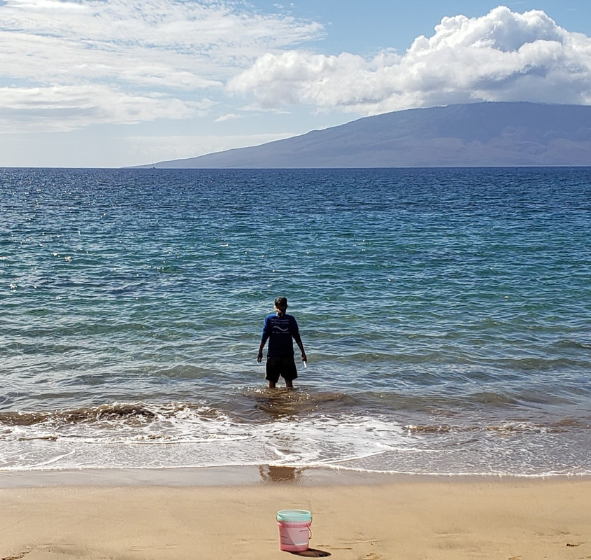
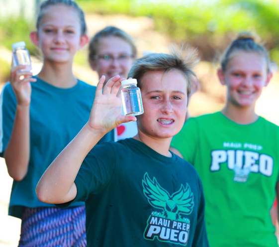
Hui O Ka Wai Ola has been testing regularly for ocean health parameters along the impacted area since late August 2023. Results for physical and chemical parameters tested have been within normal ranges. To see a list of the parameters we test for, please visit our Findings and Data page. Our team continues to wear PPE when sampling to protect from potential health hazards. Hui O Ka Wai Ola has been collecting coastal water quality data in West Maui at an increased frequency in response to the Lāhainā fire, which started on August 8, 2023. On August 15, the Hui was able to restart sampling at 14 sites surrounding Lāhainā from Honolua Bay to Pāpalaua Pali. Monitoring within Lāhainā town was resumed on August 30, including four newly added sites (Mala Tavern, Mala Ramp, Papalaua St., and Lāhainā Harbor) and at three long-established sites (505 Front St., Kauaula Rd., and Polanui-Uhailio). Our South Maui sampling efforts have continued at the normal 3 week interval for 13 sites from Māʻalaea Harbor to ʻĀhihi-Kīnaʻu NAR.
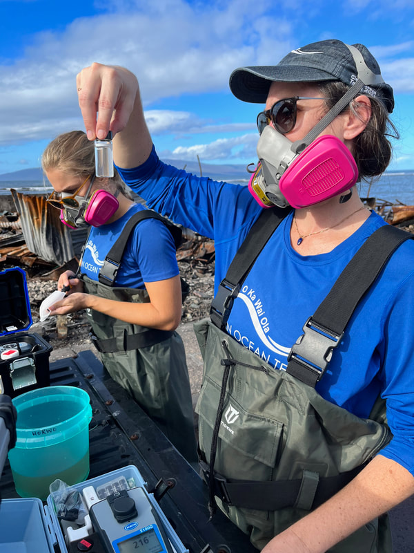
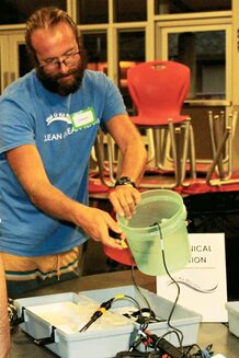
Hui staff and volunteers have been trained in protocols to ensure their safety in case of pollution in the nearshore environment while monitoring and have required an escort into Lāhainā to access sites. We have also been able to create a new position, the Lāhainā Fire Response Team Lead, led by Christiane Keyhani, to coordinate the collection of physical parameters like temperature, pH, salinity, and dissolved oxygen, which are currently showing normal ranges. Other samples for heavy metals, volatile organic compounds, and semi-volatile organic compounds have been collected by the Hui for processing by partners who specialize in these parameters, findings yet to be released. We are also collaborating with Surfrider Blue Water Task Force and have collected two rounds of samples for them in Lāhainā and some other West Maui sites for enterococcus testing. Findings from their monitoring efforts can be found on their website: Blue Water Task Force (surfrider.org). You can read more about our initial sampling efforts in this August 30 Maui Now article: Ocean water testing begins off Lahaina: Maui Now. We want to thank everyone who has supported our extra sampling efforts in Lāhainā, and those also helping to replace equipment and supplies lost in our West Maui lab. A special mahalo to the Ka‘anapali Ocean Resort Charitable Trust, Restore with Resilience, and the MANY individual donors who have contributed at this critical time, and to KaiAloha Supply for providing our team with new uniforms, despite their personal hardships in the fires. Mahalo to the Hawaiian Islands Humpback National Marine Sanctuary for allowing us to use the wet lab for all of our West Maui and Lāhainā work. While the funding has yet to be received, Hui O Ka Wai Ola is also the first group to be funded by FEMA for post-fire water quality assessment in West Maui. Our hearts go out to everyone impacted by the Maui fires. We will continue to do our part as a quality-assured, citizen science monitoring group to shed light on long term coastal water quality trends in the places we survey. A huge shout out to our volunteers, our fearless Program Manager Liz Yannell, and partners like DAR and DOH for ensuring monitoring continues during these challenging times. Two sites previously monitored by Hui O Ka Wai Ola, Olowalu Mile Marker 14 and Ukumehame, are now back on the monitoring schedule starting in May 2023! A lot of restoration work has started/is being proposed at Olowalu so resuming sampling at this site may provide insight for any shifts in the water quality as a result of management action. Additionally, we are adding Ukumehame Beach Park back into our sampling schedule because we are concerned about the coastal erosion we are seeing and want to keep our eyes on the water quality in the area.
Since September 2020, the Hui has been able to pause one additional site in West Maui (Olowalu Shore Front) and three sites in South Maui (Kilohana Dr., Keawakapu Beach, & Ulua Park), bringing us from 33 to 29 sites monitored for nearshore water quality. The Hui pauses the monitoring of sites for one or more of the following reasons: we have a good understanding of their water quality dynamics, these sites have little to no pollution or fluctuation, no management is currently underway for contributing land based pollution, and/or no permanent funding is available to continue monitoring these sites. Part of this shift to monitor fewer sites allows the Hui to expand our efforts into some other water quality research and working with partners to delve deeper into some of the pollution “hot spots” our data has helped identify. Monitoring continues at the following sites, thanks to the work of our wonderful volunteers and Team Leaders!
As of August 2020, Hui O Ka Wai Ola has gone from monitoring 41 to 33 sites! After looking closely at the data our volunteers have gathered since June 2016, the Technical Committee recommended eight sites to “pause” and one site to discontinue for one or more of the following reasons: we have a good understanding of their water quality dynamics, these sites have little to no pollution or fluctuation, no management is currently underway for contributing land based pollution, and/or no permanent funding is available to continue monitoring these sites. The Committee also added one site, Kahekili Two, which is north of the previously monitored Kahekili Beach Park site and is closer to the influence of the Lahaina Wastewater Treatment facility. Sites currently paused are:
With fewer sites to monitor, we have moved from 4 survey teams in West Maui and 4 teams in South Maui to 3 teams on each side. The teams are currently monitoring the following sites every three weeks year-round:
Part of this shift to monitor fewer sites allows the Hui to expand our efforts into some other water quality research, such as source detection, including limu nitrogen isotope testing, and working with partners to delve deeper into some of the pollution “hot spots” our data has helped identify. More on this to come!
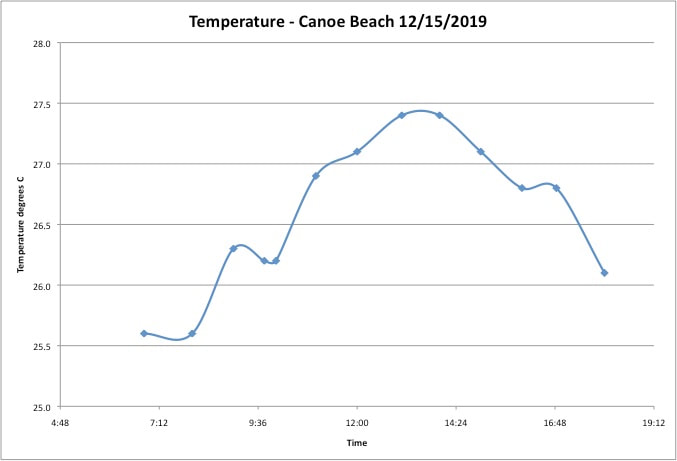
With our ongoing water quality monitoring, we are careful that we measure this parameter at each site at approximately the same time of day every time we sample so that seasonal temperature variations can be distinguished from diurnal variations.
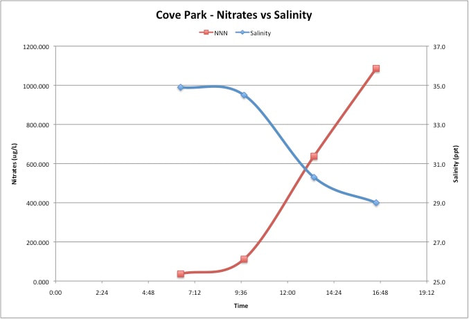
Finally, dissolved oxygen (DO) and pH levels also vary across the course of a day. Dissolved oxygen is needed for aquatic plants and animals to survive. Corals are very sensitive to changes in ocean chemistry, including increased ocean water acidity (which results in a drop in pH levels). During our 12 hour study, we found that in Cove Park and Hanaka‘ō‘ō Park these diurnal variations are not as obvious because of the influx of fresh ground water as the tide is going out which also affects levels of pH and DO. In general, pH and DO are at their lowest levels just as the sun rises due to the fact that photosynthesis has not been taking place overnight. CO2 levels rise at night as marine organisms respire, taking in oxygen and producing CO2. There is no photosynthesis at night so as CO2 levels rise, the water becomes more acidic and pH levels drop. Dissolved oxygen also drops because of a lack of photosynthesis that generates oxygen as a bi-product. Once the sun begins to rise, photosynthesis begins again, and the pH and DO levels rise.
|
Archives
April 2024
Photo: Header - Bruce Forrester
|
 RSS Feed
Proudly powered by Weebly